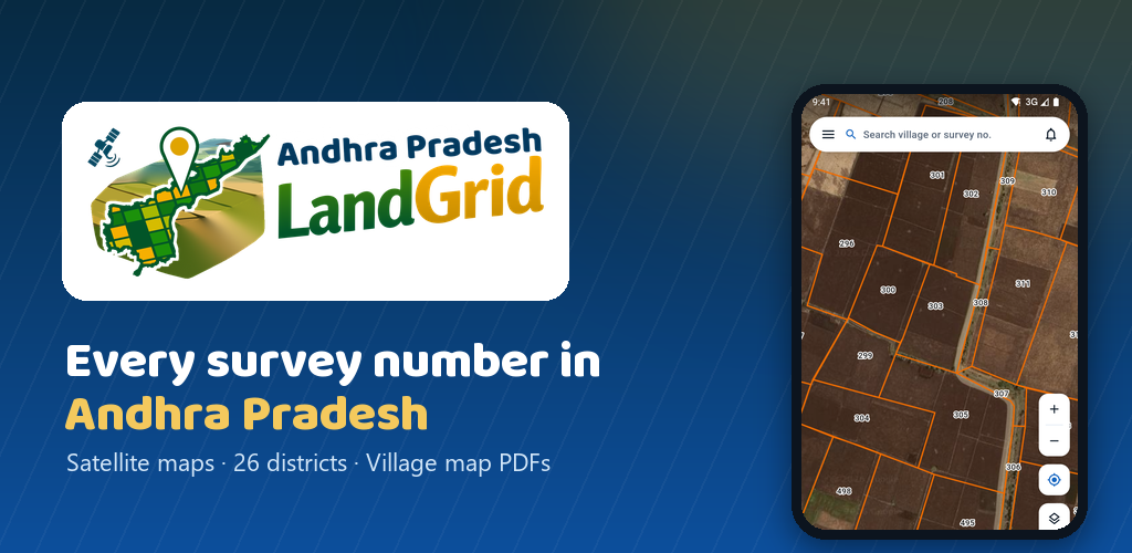
Hyderabad, October 2026: Hyderabad-based Tech Avenue Labs, the team behind the Telangana LandGrid app, has launched Andhra Pradesh LandGrid, a free mobile app that lets users find survey numbers anywhere in Andhra Pradesh on a satellite map. The app is now available on Android and iPhone.
The launch comes as land buyers, farmers and NRIs increasingly look for simple ways to understand a piece of land before visiting it. For many families in Telangana who own ancestral land or are buying plots in Andhra Pradesh, locating the right survey number from a distance has often meant relying on brokers or multiple trips to the village.
Tap a field, see its survey number
Andhra Pradesh LandGrid draws survey boundaries over high-resolution satellite imagery. Users can zoom into their village and tap any field to see its survey number, village, mandal, district and approximate area. Users can search by village name, mandal name, or survey number, enter coordinates, or use GPS to start from where they are standing.
The app covers villages across all districts of Andhra Pradesh, from Srikakulam to Chittoor, organised under the new district names. The survey boundary data comes from Bhuvan, the publicly available geoportal of the National Remote Sensing Centre (NRSC), ISRO.
Measure land and download village maps
Beyond search, the app includes land measurement tools. A polygon tool calculates area and perimeter, while line tools measure road frontage and boundary lengths, with every side labelled on the map. Areas are shown in acres, guntas and square yards, the units most commonly used in local land deals.
Users can also download a printable A3 village survey map in PDF format showing the survey numbers and boundaries of an entire village, with a free sample available to preview before purchase. A free land-for-sale section allows owners to post land on the map and buyers to contact sellers directly.
Built for local users
The app is available in both English and Telugu and works without creating an account. Users sign in only to buy maps or back up saved items. The app is free to use and supported by ads.
“After Telangana LandGrid, the most common request we received was for Andhra Pradesh,” the team said. “Many of our Telangana users also have land or family property in AP, and they wanted the same simple way to see it on a map.”
For reference, not legal use
The developers stress that Andhra Pradesh LandGrid is an independent private app and is not affiliated with the Government of Andhra Pradesh. Maps, boundaries and areas shown are for general reference only and may differ from revenue records. The app does not show ownership details. Buyers are advised to verify land through official records such as Meebhoomi and their Mandal Revenue Office before any purchase or sale.
Availability
Andhra Pradesh LandGrid can be downloaded from the Google Play Store and the Apple App Store.