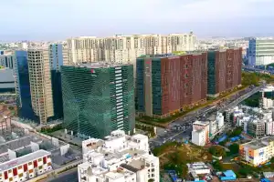
Hyderabad: The State government is working quickly to map properties in Greater Hyderabad using geospatial technologies. This effort aims to improve urban planning and provide better services to citizens. The Greater Hyderabad Municipal Corporation (GHMC) has already mapped 158 square kilometers using drones. In this area, 1,14,020 properties have been digitized in Kukatpally, Moosapet, Chandanagar, Uppal, and Hayath Nagar circles.
The GHMC is conducting a comprehensive Geographic Information System (GIS) survey. This survey maps all properties and utilities in its jurisdiction. It includes aerial surveys using drones and door-to-door mapping by on-ground surveyors to collect geo-location data. GHMC Commissioner Amrapali Kata assured that personal data would be protected during the survey. The focus is on collecting information related to properties, utilities, and infrastructure to enhance urban planning and resource management.
Each property will get a unique identification number, known as a Digital Address. This ID will help in delivering services like garbage collection and emergency management. The commissioner urged residents to cooperate with the survey and not to fall into any misconceptions.

In three circles—Serilingampally, Gajularamaram, and RC Puram—the survey will be completed soon. These areas include Madhapur, Serilingampally, Allwyn Colony, Vivekananda Nagar Colony, Gajularamaram, Subhash Nagar, Nagole, and RC Puram.
Currently, 90 teams are working on this project. More teams will be added as needed, and the mapping is expected to be completed in the next six months.
GHMC is also working with Self-Help Groups (SHGs) and Residents’ Welfare Associations (RWAs) to speed up the survey and ensure thorough coverage. This collaboration builds trust and cooperation among residents, making the initiative more effective and inclusive.
The integrated GIS database will benefit citizens by improving city planning, maintenance, public involvement, emergency response, utility services, navigation, infrastructure development, garbage collection, and safety and security.