Hyderabad: The Mining Surveillance System (MSS) was introduced in 2016 to help prevent illegal mining in India. Since its launch, it has become a useful tool in identifying and reducing such activities.
Union Minister for Coal and Mines, G Kishan Reddy, shared that in the first year, the MSS identified 296 cases of possible illegal mining. In the following years, it reported 52, 177, 138, and 157 cases, respectively. Currently, the system monitors 3,405 mining leases.
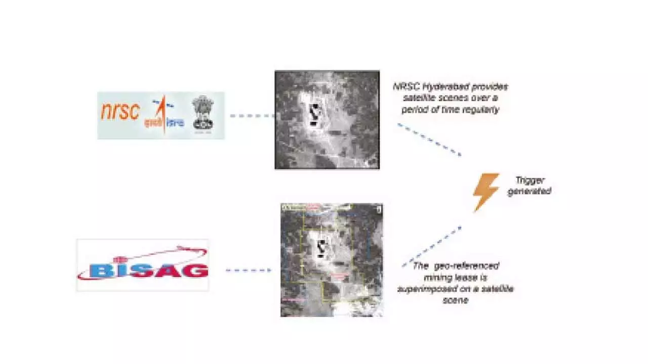
Initially, the MSS was developed for major mineral leases. Now, it includes a portal for all stakeholders. This system can provide detailed information, from state-level data down to specific mine details. Users can compare different types of scenes and information layers to get a clearer picture.

Many minerals extend beyond the leased land. The MSS uses satellite images to watch areas up to 500 meters outside the lease boundary. This helps in monitoring any unauthorized mining activities nearby.
The technology relies on satellites and requires little human involvement, ensuring transparency. It provides an unbiased record of activities around mining areas. People can also report unusual mining activities, helping verify such events. The National Remote Sensing Centre (NRSC) in Hyderabad supplies regular satellite images. When these images are compared with known mining areas, any illegal activities become clear, enabling quick action.
The Union Minister highlighted in Parliament that this satellite-based system supports State Governments in stopping illegal mining. It flags any unusual changes in land use within 500 meters of a mining area, prompting state authorities to investigate further.