Two powerful weather systems are developing in the Bay of Bengal, bringing significant changes to weather patterns across southern India.
A dangerous low-pressure system has already grown into a depression and will continue moving west-northwest over the next day. Weather experts expect this system to gain more strength initially. The depression will then lose power as it reaches the central Bay of Bengal.
Meteorological Department officials say they will have better information about where this depression is heading on Wednesday and Thursday.

Another weather system is forming near southwest Bay of Bengal, close to Sri Lanka. This second depression will likely become a severe low-pressure system by Wednesday. Within 24 hours after that, it should develop into a full depression.
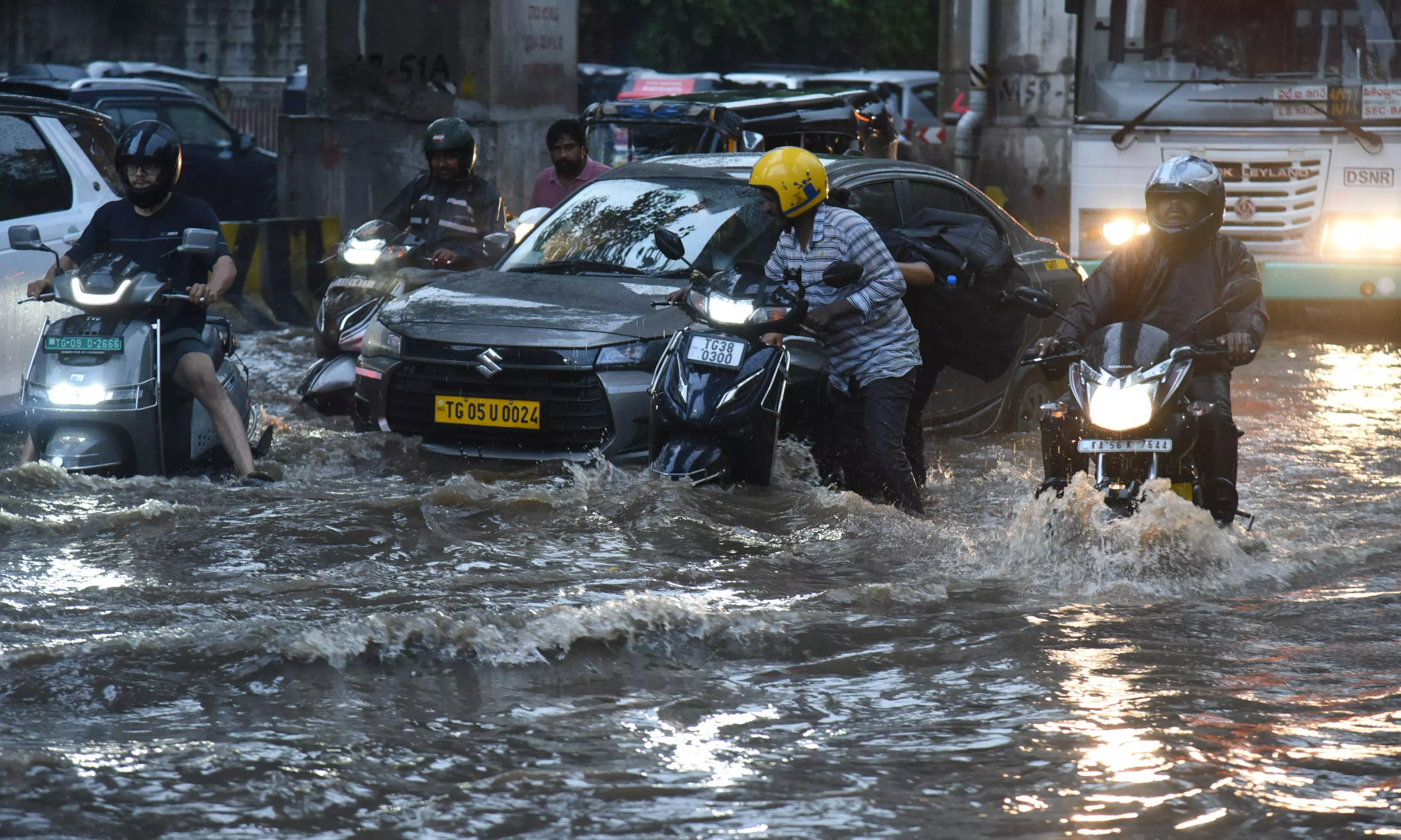
Both weather systems are moving toward the north Tamil Nadu coastline. After hitting that area, they will affect coastal Andhra Pradesh before losing strength.
These weather patterns will bring heavy rains to several districts across Telangana on November 30 and December 1.
Meanwhile, the recent cold weather in Telangana has ended. Temperature readings show warmer conditions returning to the region.
Medak recorded the coolest temperature at 13.8°C. Other areas showed higher readings: Patan Cheruvu at 14.4°C, Adilabad at 14.7°C, Hayat Nagar at 15°C, and Rajendra Nagar at 17°C.
Several locations recorded similar temperatures around 17-18°C. Hanumakonda and Ramagundam both reached 17.5°C. Nizamabad hit 17.6°C, while Dundigal recorded 17.7°C.
Nalgonda and Hyderabad both measured 18.2°C. Hakimpet showed 18.7°C, and Mahabubnagar reached 19.1°C.
The warmest areas were Khammam at 20.4°C and Bhadrachalam at 20.8°C.